Environmental Sampling and Monitoring
Environmental sampling and monitoring is a process that given a certain environmental attribute of interest (e.g., the concentration of spilled oil in the water or the density of leaked gas around a factory), corresponding measurement samples are collected from different locations so that a "distribution map" can be reconstructed. The distribution map is not simply the averaged value of collected samples, but a continuous map that describes or predicts the variations of the entire field. Such a mapping mechanism is also called environmental state estimation, which is also a learning process where the parameters of an underlying environment model need to be learned using streams of incoming sampling data collected by the robots. By taking advantage of the learned model (e.g., reconstructed map) of the environment, the robots are then able to plan meaningful path for the subsequent sampling actions.

For quite a long period robotics research has been conducted in indoor laboratories where environments are typically static. Increasingly, the demands of modern applications and technologies require that robots move to outdoor space, such as in the air or under water, with constantly prolonged task durations (i.e., long-term or life-long autonomy). In the meantime, these real-life scenarios have raised a critical challenge: many natural or man-made environments are dynamic, so are the associated environmental attributes. In other words, it is very common that the environmental parameters change not only spatially, but also temporally. In order to provide a good estimate of the state of the environment at any time, the environmental sensing (information gathering) needs to be carried out persistently to catch up to the environmental dynamics. One focus of our research has been developing principles that (1) use data-driven methods to guide robots to learn the spatio-temporal and stochastic environment model, and (2) utilize the learned model to seek for path planning and decision-making solutions, which in turn benefits future environmental exploration and exploitation for efficient monitoring.
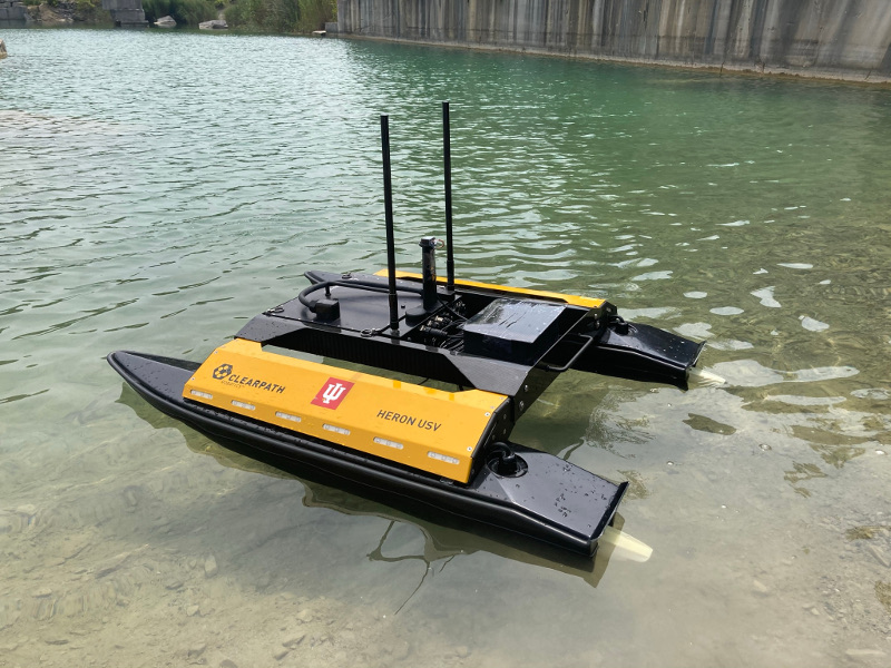
Left and middle: an autonomous surface vehicle performs sampling; Right: optimized sampling path is generated by following batches of waypoints computed from information-seeking algorithm.

We have designed informative planning and learning methods that enable an autonomous surface vehicle to perform persistent monitoring tasks by learning and refining the underlying distribution map. To acheive real-time decisions and alleviate computational bottleneck caused by sampling data accumulated, we developed a framework that iterates between two components: a planning component that aims at collecting information-rich samples, and a sparse Gaussian Process learning component where the environmental model and hyperparameters are learned online by taking advantage of only a subset of data that provides the greatest contribution. In addition, we also developed an uncertainty-aware informative planning method that integrates information-theoretic and decision-theoretic frameworks, so that both the informativeness-based routing and disturbance-induced action uncertainty are taken into account simultaneously, leading to high efficiency and accuracy for environmental sensing and monitoring.
Left: planned informative path (yellow dots are saved samples); Middle: reconstructed distribution map; Right: prediction variance.
YouTube link:
Related Papers:
(Best Application Paper Award Finalist, also Best Student Paper Award Finalist)


